Full automation for land, design, and permits
Search. Design.Permit. Build.
Everything connected. Powered by real-world property intelligence.
128,414
PROPERTIES ANALYZED
1,204,339
ENGINEERING CALCS
46,103
PERMIT DOCUMENTS
210,885
LAND OPPORTUNITIES
SCROLL — ENTER THE PROPERTY
MUNICIPAL PERMIT PACKAGE
L1 — Max-Allowance Two-Bed
SP-1 · A-1…E-1 · S-1 · EX · SV · P-1 — 9 DOCUMENTS
✓ Site plan — scaled, stamped-ready
✓ Architecture set — locked model L1
✓ Permit checklist — by-right path
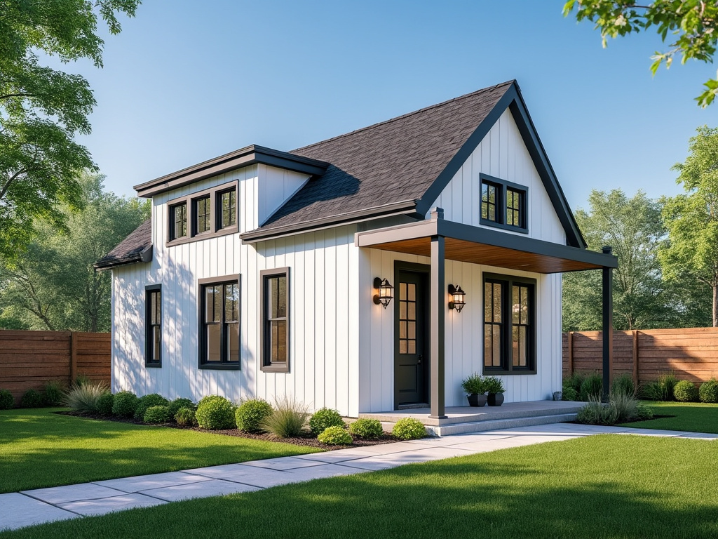
01 / 06
ONE COUNTRY
Every parcel in America — reachable in seconds.
02 / 06
ONE CITY
Zoning, terrain and risk resolved block by block.
03 / 06
THE ENVELOPE
Setbacks computed. Buildable area found. 2.1 seconds.
04 / 06
THE FIT
The largest home that fits — placed automatically.
05 / 06
DRAWINGS
Permit-ready plans draw themselves.
06 / 06
BUILT
From search to keys. One system. No hand-offs.
CORE PLATFORM
Eight disciplines. One connected system.
Everything that used to live in separate firms, formats and months of hand-offs — running as one continuous pipeline.
01 · Property Intelligence
Search any property. Know everything.
Parcel, owner, buildings, permits, utilities, flood, wetlands, elevation, roof form, distress signals and development potential — in one live card.
02 · Land Intelligence
Find the deals nobody else sees.
Vacant land, distressed property, assemblage plays and highest-and-best-use — scored across entire regions.
03 · Survey
Terrain, resolved.
Contours, boundaries, slope, drainage and NGS control benchmarks — packaged automatically.
04 · Architecture
Plans that draw themselves.
Floor plans, elevations, sections, schedules — kitchens cabineted, baths code-clear.
05 · Structural Engineering
The frame assembles itself.
Footings, beams, columns, roof framing and basement underpinning — sized with the calcs to prove it.
06 · ADU Designer
Five locked models. Zero surprises.
Studio to two-bed farmhouse — photoreal render, plan set, budget and schedule locked together. The home you see is the home that gets built.
07 · Permit Intelligence
Permits without the maze.
Application → engineering → review → approval → inspection → certificate of occupancy. Tracked and assembled for you.
✓ Application assembled
✓ Zoning path resolved
✓ Documents generated
✓ Review tracked
✓ Inspection scheduled
08 · Development Intelligence
From a single ADU to a full development.
Apartments, affordable housing, subdivision and mixed-use — site optimization, financial modeling and feasibility in one pass. Six-unit funding packages, generated.
0+
PROPERTIES ANALYZED
0+
ENGINEERING CALCULATIONS
0+
PERMIT DOCUMENTS GENERATED
0+
LAND OPPORTUNITIES FLAGGED
0+
DRAWING SHEETS ISSUED
0+
HOURS SAVED
0+
SITE PLANS GENERATED
0T
CARBON AVOIDED
PROPERTY SEARCH
Type an address.
Watch the property explain itself.
One search resolves ownership, geometry, environment, zoning envelope, model fit and build economics — live, in seconds. No county websites. No PDFs. No waiting.
< 10s
TO FULL PROFILE
30+
DATA LAYERS
0
MANUAL LOOKUPS
▍
ADU DESIGNER — LOCKED MODELS
The home you see is the home that gets built.
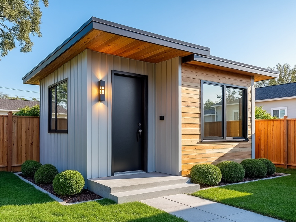 ◆ LOCKED RENDER + PLAN SET
MODERN STUDIO
M2 — Two-Bedroom Cottage
750
SQ FT
2/1
BED / BATH
25×30
FOOTPRINT
Permit-ready
FULL PLAN SET SP-1 · A-1…E-1 · S-1 — LOCKED
✓ Photoreal render, locked
✓ Full plan set A-1…E-1, locked
✓ Kitchen + code-clear baths drawn
✓ Placed on your parcel automatically
FULL AUTOMATION
What took an industry months happens in seconds.
The moment a parcel resolves, Korva's automation engine reads the zoning, computes the envelope, places the home, draws the plans, sizes the structure and assembles the permit package. No hand-offs. No re-keying. No waiting on five firms. Speed like this is how teams scale — from one lot to a thousand.
WHY KORVA
The traditional process is a relay race between strangers.
THE TRADITIONAL WAY
6–14 months
FIVE FIRMS · FIVE FORMATS · ZERO SHARED CONTEXT
THE KORVA WAY
Days, not months.
ONE SYSTEM · ONE SOURCE OF TRUTH · FULL AUTOMATION
DEVELOPMENT WORKFLOW
Everything connected. Nothing dropped.
01
Search Property
Any address. Full intelligence in seconds.
02
Analyze
Zoning, environment, risk and buildable envelope.
03
Survey
Boundaries, terrain, contours, NGS control.
04
Architecture
Locked plan sets, drawn automatically.
05
Engineering
Structure sized, calcs attached.
06
Compliance
Egress, clearances and code notes — checked.
07
Permits
Package assembled, path resolved.
08
Construction
Locked design — built exactly as shown.
09
Inspection
Checklist tracked to sign-off.
10
Completed Project
From search to keys — one system.
WHO BUILDS ON KORVA
One system. Every seat at the table.
Developers
Feasibility to funding package in one pass.
Architects
Locked plan sets, schedules and code notes.
Engineers
Structure, loads and underpinning — sized.
Contractors
Bid-ready documents and locked scopes.
Municipalities
Clean, consistent, reviewable submissions.
Surveyors
Boundary, terrain and control — packaged.
Investors
Deal scoring across entire regions.
Banks
Underwrite with real build economics.
Insurance
Risk layers resolved per parcel.
Utilities
Territory and service intelligence.
Homeowners
See the ADU your yard can hold — priced.
+ ANYONE WHO BUILDS
BUILT ON — AND CONNECTED TO — THE SYSTEMS YOU ALREADY TRUST